Withers Local Area Plan

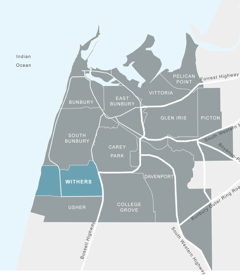
The Withers Local Area Plan (LAP) sets out an agreed, top-down and bottom-up, suburb-wide framework for the future of Withers - a suburb within the City of Bunbury, located approximately 5km south of the Bunbury CBD.

The objectives for the Withers LAP focus on a shared vision of four themes - community diversity, land rationalisation, improved connectivity and increased amenity - to enable a coordinated approach to the urban renewal of the site.

The Withers LAP identified neighbourhood precincts, each with distinguishing characters, densities and uses. These neighbourhood precincts sit between two large-scale open spaces - Hay Park to the east and Maidens Reserve to the west.

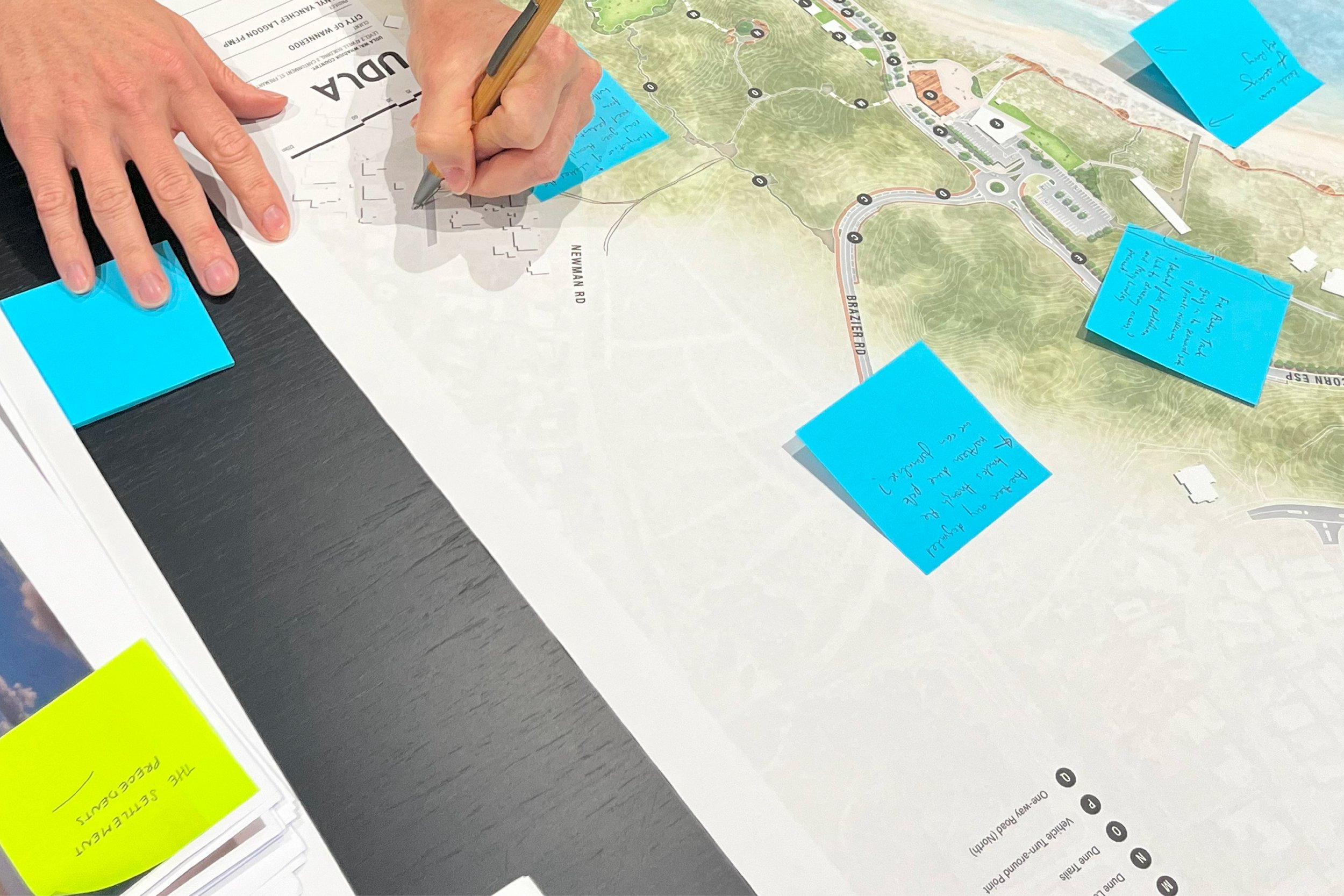
The UDLA team worked closely with a number of ‘community champions‘ to communicate with and learn with the people of Withers. This was integral to an outcome which responded to Withers’ unique identity, and ensured the process was directly aligned with both community and local government needs, expectations and resources.
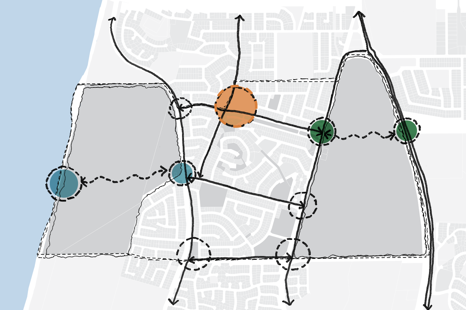
Improved connectivity through the neighbourhood and to the beach (blue), as well as to the hospital were key drivers of the Withers LAP. Another key driver was a strengthened commercial and civic area (orange) to create a gateway to Withers.
The road network within Withers was characterised by poor connectivity with numerous cul-de-sacs and dead ends, resulting in excessively long road trips and restricted access for emergency and public services. The LAP proposes a series of adjustments to the road network to improve connectivity, both internally and to to its surrounding regional assets.

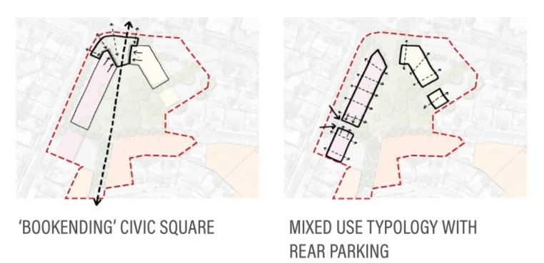
The LAP identified an opportunity for a strengthened commercial and civic area, in the central northern gateway to the suburb. This area, referred to as the Withers Community Hub, was designed to build on the existing Withers Library amenity, adding complementary civic and commercial uses and higher density residential infill positioned around a civic square and public open space.


The LAP was developed to function as a fluid, place-inspired decision making tool. It builds upon the Withers Urban Renewal Strategy (WURS) and translates findings into a spatial plan to guide and shape future planning interventions including: strategic redevelopment sites, land use, road and pathway networks and infrastructure services.
Awards:
2016 Australian Institute of Landscape Architects (AILA) WA Award of Excellence for Communities
Details:
Client: City of Bunbury, Housing Authority and South West Development Commission
Aboriginal Country: Wardandi Noongar Country
Location: Bunbury, WA
Dates: 2014 - 2016
Landscape Architect: UDLA
Collaborators: Withers Local community, including Aboriginal Community Representatives